My Cart
  • Running & trail
  • BIKE
  • OUTDOOR
  • FITNESS
  • SWIMMING & TRIATHLON
  • WATCHES & GPS
  • Brands
  • Promos

Cap Diffusion Top 25 - Saint-Tropez/Sainte-Maxime/Massif des Maures Blue

€13.40
SKU
3545OT

In stock

Shipped Monday

Free delivery on orders over 90€
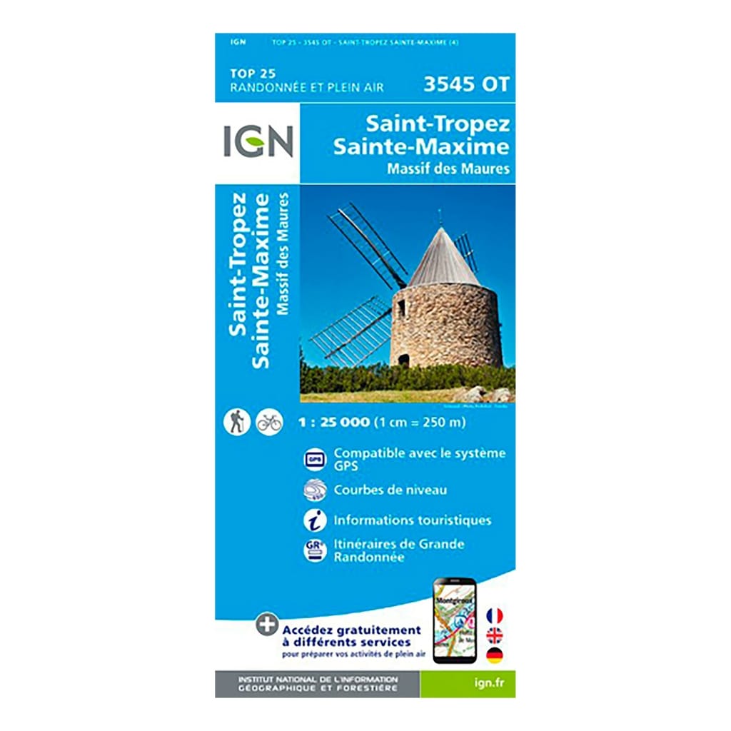
IGN Top 25 Saint-Tropez / Sainte-Maxime / Massif des Maures hiking map - Scale 1:25,000 The IGN Top 25 Saint-Tropez / Sainte-Maxime / Massif des Maures hiking map, ideal for hiking, will allow you to Find your way easily and precisely during your outings in the region. Very precise, it highlights all the existing details on the ground: communication routes to the smallest path (marked or not), constructions, wood, isolated tree, river, source and tourist information. The representation of the relief by level curves allows you to have an idea of the difference in height to come, in order to allow you to draw routes adapted to your desires.
  • Scale: 1:25,000 (1cm = 250 meters on the map)
  • Compatible with GPS system
  • Contour line
  • Tourist information
  • Long-distance hiking routes (GR)
  • Date of publication: February 2018
  • Size: 96cm x 132cm

  • Municipalities covered : Rayol-Canadel-sur-Mer, Le Lavandou, La Môle, Cogolin, Le Plan-de-la-Tour

    Places to discover : Gulf of St-Tropez, Forest of the Maures, Pointe des Sardinaux, Les Pradels, Col de Collebasse, Col du Canadel, Cap Camarat, Cap Taillat or Cap Cartaya, Massif des Maures, Cap Lardier

    Product Name Cap Diffusion Top 25 - Saint-Tropez/Sainte-Maxime/Massif des Maures Blue
    Original Product Name Top 25 - Saint-Tropez/Sainte-Maxime/Massif des Maures
    SKU 3545OT
    Gender Mixed
    Bar code 9782758542858
    Brand Cap Diffusion
    Color Blue