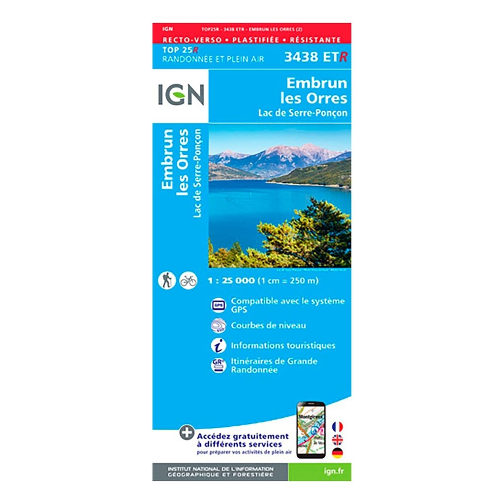
IGN Top 25 Embrun / Les Orres hiking map (resistant) - Scale 1/25,000 The IGN Top 25 Embrun / Les Orres hiking map, ideal for hiking, will allow you to find your way easily and precisely during your outings in the countryside. region. Very precise, it highlights all the existing details on the ground: communication routes to the smallest path (marked or not), constructions, wood, isolated tree, river, source and tourist information. The representation of the relief by level curves allows you to have an idea of the difference in height to come, in order to allow you to draw routes adapted to your desires. The IGN Top 25 card is also resistant, you can take it everywhere with you without risk of tearing it.
Resistant, plastic card Both sides Scale: 1/25,000 Date of publication: March 2019 Size: 96cm x 132cm
Municipalities covered : Prunières, Montclar, Crots, Espinasses, Rousset, Le Sauze-du-Lac, Saint-Sauveur, Puy-Saint-Eusèbe, Embrun, Saint-Apollinaire, Puy-Sanières, Montgardin, Le Lauzet-Ubaye, Pontis, Baratier , Les Orres, Les Thuiles, Saint-André-d'Embrun, Bréziers
Places to discover : Lake of Serre-Pon├ºon, Forest of Boscodon, National Forest of La Blanche, National Forest of Riou Bourdoux, Pic de Boussolenc, Tête de la Mazellière, Aiguilles de ChaBrières Regional Natural Park, Les Parias, Mont Guillaume , Aupillon, the Demoiselles Coiffées, Cirque de Bragousse, Cirque de Morgon, Plateau de Dormillouse
| Product Name |
Cap Diffusion Top 25 - Embrun/Les Orres (résistante) Blue |
| SKU |
3438R |
| Original Product Name |
Top 25 - Embrun/Les Orres (résistante) |
| Gender |
Mixed |


Or
Or
Your data is processed and collected by Lepape, which acts as the data controller, in accordance with the French Data Protection Act and the RGPD. For more information on the processing of your personal data, you can consult our Privacy policy.