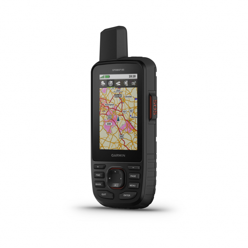
The Garmin GPSMAP 66i handheld GPS , shown here in black, is designed for the most remote hikes . Robust and high-end , it combines precise navigation functions and inReach satellite text communication. Effective even in difficult conditions, the GPS has a large color screen that can be read even in direct sunlight . Its autonomy of 200 hours (in expedition mode) allows you to fully enjoy your treks and hikes over several days. The device saves your position every 10 minutes. Thanks to the inReach satellite communication system, you stay in touch even when the mobile network is non-existent: you send and receive messages to/from whoever you want, and you can even send interactive SOS to GEOS (Centre for coordination of the search and rescue, continuously open). Preloaded Garmin TopoActive Europe maps provide detailed views of elevations, peaks, parks, coastlines, rivers, and geopoints. You get high-resolution, photorealistic views with BirdsEye Sattelite imagery. The numerous navigation sensors allow you to follow your position and navigate in the most difficult places, at the same time as a weather report informs you of the forecast. Compatible with Garmin Explore website and app and Garmin Connect community.

 4 x 134.75 € free of charge


 France
Français
France
Français
 Belgique
Français
Belgique
Français
 Deutschland
Deutsch
Deutschland
Deutsch
 España
Español
España
Español
 Italia
no
Italia
Italiano
 Portugal
Português
Portugal
Português
 Nederlands
Nederlands
Nederlands
 Schweiz
Deutsch
Schweiz
Deutsch
 Luxembourg
Français
Luxembourg
Français

The information below is required for social login
Sign In
Or
Create New Account
Or
Your data is processed and collected by Lepape, which acts as the data controller, in accordance with the French Data Protection Act and the RGPD. For more information on the processing of your personal data, you can consult our Privacy policy.